Welcome back Blue Ocean Mariner readers! It has been so long ago that I made a real post, that I had to go back and read where I left off. I had tried several times onboard the ship to update, but the internet was so slow that I ultimately abandoned the effort several times. I’ve debated entering several smaller posts over the next week, but decided to just make one big entry and dump it all out at once so I don’t forget anything.
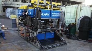
Jason ROV – Axial Seamount:
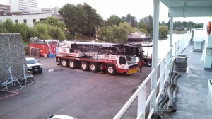
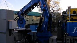
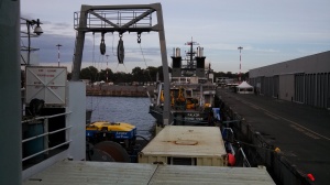
Just after offloading the ROPOS ROV in Victoria (see earlier post) and returning to Seattle, we had a 10 day stretch at the dock where we caught up on maintenance, organized the deck for the next oncoming science party and began to receive their equipment onboard. The next trip was with the Woods Hole Jason ROV. The loading all starts with a 175 Ton shore side crane coming in and loading all of the heavy lifts. They start on the bow and load containers of spare rov parts, then move to the aft deck and load the rov control vans and the rov and rov launch crane. Then the shore side crane leaves and everything is wired, lashed, bolted down, organized, etc.
We headed back out to the Axial Seamount, 300NM off of Central Oregon. This is the same project we were on the last leg with the ROPOS ROV. The ROPOS leg was installation of the cabled observatory with lots of instruments, cables, junction boxes and related hardware being deployed. This leg with Jason studied the hydrothermal vents, microbiology, oceanography, energy and other things I don’t fully understand. For example, one of the projects included putting a cap on a hydrothermal vent and creating an electrical energy source. The experiment was a success and they were able to generate a pretty good amount, although I can’t remember what that was.
We also spent considerable time deploying benchmarks that were set in several locations on top of the seamount. Then a super accurate pressure sensor was placed on top of each benchmark and recording were taken. At future visits to the seamount, more readings can be taken and note the changes in elevation of the seamount. The seamount has risen 11′ since 2011 and may be getting ready to erupt again soon.
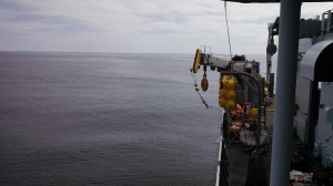
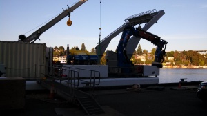
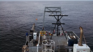
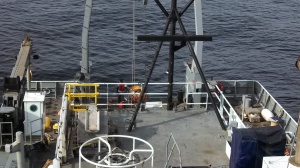
Unlike the ROPOS ROV which uses the lemon floats to carry the weight of the cable, the Jason ROV uses a unit named Medea that bears the load of the cable and then tethers the Jason ROV so that the ROV can roam freely without being shock loaded be the cable as the ship surges in the sea. The other notable feature of the Jason system is that the Jason crew takes control of the ship while they are diving on station. They can slowly maneuver the ship from their control van and have it follow the rov where they need it to go. The control of the ship can be immediately returned to the bridge if the need were to arise.
That’s all fine and dandy until the bow thruster takes a dump. The thruster itself did not die, but rather the motor that controls the direction of thrust. There was no way possible for the ROV control van to control the ship without a functional bow thruster while sitting on DP. Control was resumed on the bridge and every time the ROV needed to move a phone call was made to bridge to explain where they wanted to go and at the same time a electronic chart on the bridge was updated by the ROV control showing the heading and distance to their next location. Along the same time we had some incredibly calm conditions that actually made keeping the ship on course harder. It was easier with about 15 knots of wind and gave some force to lean into. Without the wind, controlling the bow was a challenge. Near the end of the trip, the work around consisted of calling the engineers and having them move the thruster to either 90 or 270 and then the bridge could apply thrust in the direction they wanted to go. It helped tremendously to maintain the ship on station and the ROV was able to complete their job.
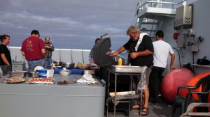
We did manage to sneak in a few barbeques on the bow for over the trip due to the great weather:
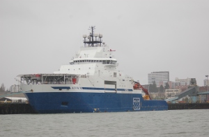
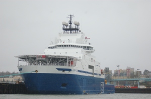
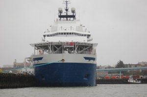
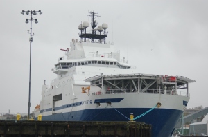
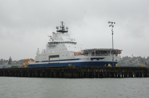
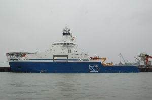
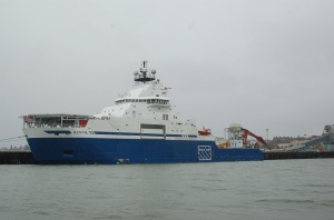
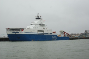
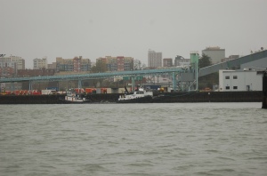
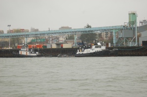
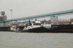
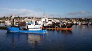
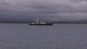
At the end of the trip, we again went to Victoria, Canada to offload a bunch of our science party. They were boarding the R/V Falkor. The Falkor is owned by Schmidt Ocean Research Institute and was started by Eric Schmidt of Google fame. We tied up directly behind the Falkor and in the photo you will see the ROV ROPOS onboard while the ROV Jason is onboard our ship, the Thomas G. Thompson. If you look closely at the photo of the Falkor, you can see that they have two satellite domes. I seriously doubt they have any issue connecting to the internet, especially when your boss is the CEO of Google.
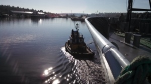
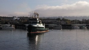
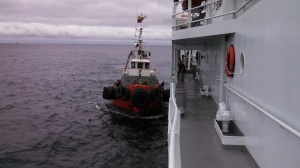
We were only in Victoria about four or five hours and then departed again for Seattle. With no functional bow thruster, we had to be taken under tow by a Western Towboat tug to pass through the locks. As the lock gates opened and the towboat leaned on the throttles, there was a huge explosion of salmon off the boat of the tug. The engine noise must have scared them. It was right during the peak of the salmon run. Unfortunately I was unable to take a picture.
Western Towboat towing the Thompson:
Student Cruises:
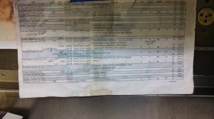
Part of the University of Washington charter agreement with the Navy is to provide so many days of student learning / cruises. Many of the crew do their very best to schedule their time off during these evolutions. You can see from the schedule below were in and out of port numerous times sometimes a few times per day. The weather during the student cruises was FUBAR as well, making things more difficult. We had gusts to 40 knots in Puget Sound and solid rain for the week. I enjoyed the student cruises for the most part. We earned lots of overtime and I really got a chance to work the mooring lines multiple times (which is a great workout).
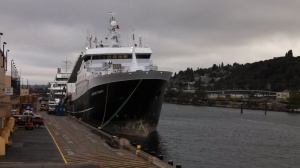
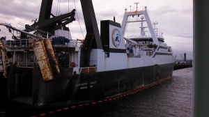
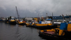
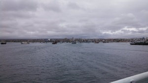
The student trips were run mostly from pier 91 in Seattle, which allowed much easier tie ups than going all the way into the locks to the University Pier. Pier 91 is where most of the large trawler fleet is based. These trawlers fish the Bearing Sea and the coasts of Oregon and Washington for hake, sole, cod, etc.
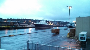
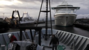
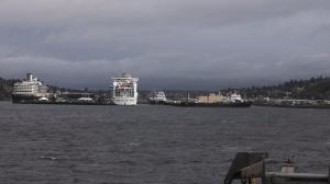
During one of the cruises, we stayed tied to the pier. Overnight a huge cruise ship docked just off our bow. In the morning, we had to thread between a couple of factory trawlers on the left and the cruise ship on the right. The wind we blowing off our Stbd. Bow as we left the dock. As we passed the cruise ship, it blocked all the wind, then as we came out from behind the ship the wind blasted us again. The crew did a great job keeping us off the line of factory trawlers.
Here is the hole:
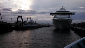
Tight Squeeze:
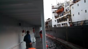
The hole from a different view. We came out just to the right of the cruise ship on the right:
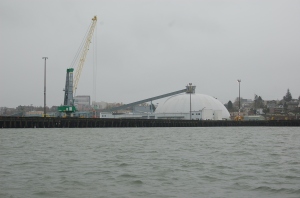
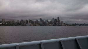
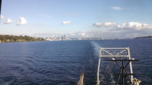
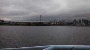
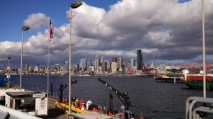
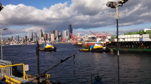
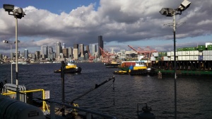
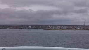
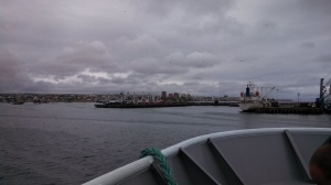
Pier 91, where the student cruises launched from, has great views of the downtown Seattle skyline:
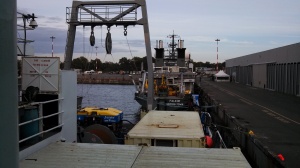
A couple of the student cruises were all the way out to the coast off of La Push, WA. The first time (early in the week) was to restive a scientific mooring / buoy and bring it to port so it could be maintained. Along the way we did a number of CTD stations. I forgot to take a photo of the CTD unit itself, but it basically takes water samples at various depths dictated by the science party. The CTD is deployed on out Hydro Boom that stick out of the Stbd. side of the ship and is deployed / retrieve with our winches.
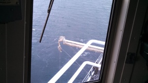
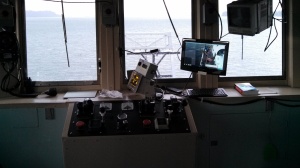
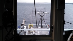
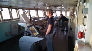
Winch control station and view from the winch control:
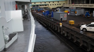
At the end of the week we took on fuel, getting ready to depart for South America. The fuel dock has a nice view as well:
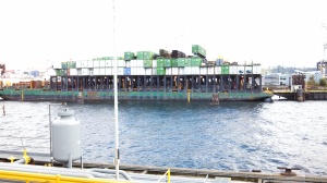
The fuel pier we use, is right next door to Northland Services. Here is one unique barge that loads containers on the top and then loaded rail cars are loaded on the bottom. When they arrive at their destination, they wheel the rail cars off. Pretty cool idea!
A couple of Western Towboat tugs arrived to make up to the Northland Barge.
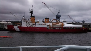
On the other side of the fuel pier is the Vigor Shipyard (formerly Todd Shipyard). They are overhauling the USCG Icebreaker Polar Star:
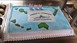
Somewhere during the student cruises, the Thomas G. Thompson celebrated her 300th voyage:
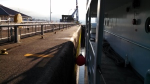
At the end of our student cruises, we had one last entry into the Ballard Locks and the ship canal. Inside the Ballard Locks:
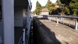
Some fishing vessels waiting for us to clear out so they can enter the locks and the Corbin Foss waiting to exit:
One last time to the U of W Dock. Same thing as before, a shore side crane came along side the next morning and loaded 7 containers beginning on the bow. Two of the containers on the bow are refrigerated that will be used to hold garbage while in the tropics on a long leg. There was a scurry of science people that arrived and seemed allot like anarchy as each group wanted priority over their equipment to be loaded, hooked up, lashed, etc. It’s surprising no one was injured.
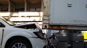
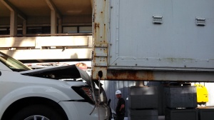
One of the containers that was delivered to us on a long haul truck, also had a wrecked car as part of the load. The crane operator thought it would be funny to make it look like they smashed the car by accident with the container. The next morning, the University’s Port Captain and Marine Superintendent came onboard for breakfast and I showed the car we smashed the day before. They just sat looking at the photos in disbelief and wonder why the accident wasn’t reported until I spilled the beans that it was all a set up photo.
It looks pretty real, doesn’t it?
We pulled off the U of W Dock one last time. The Thompson won’t be back again until next summer.
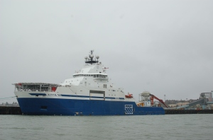
On the way out we passed Western Towboat and their nice shiny fleet. They keep their equipment in perfect condition:

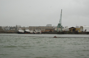
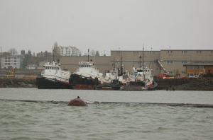
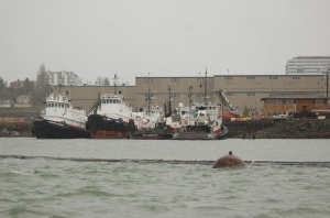
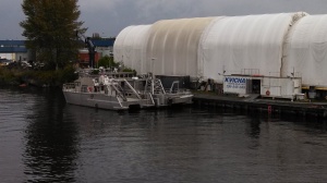
Also passed Kvichak, builders of some really badass aluminum boats:
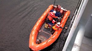
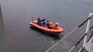
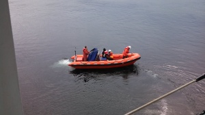
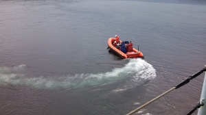
We made our way into the locks and everything was going fine. I was assigned to the bow, as normal with a couple of other ab’s. To exit the locks and head to sea, you would have to normally wait for a train bridge to be opened. Normally we would sit in the locks with gate open, waiting for the bridge. While we sit the water has a chance to mellow out and there is very little current when we do pull out. I’m pretty sure the bridge was telling us to come on through or something, because we didn’t wait like normal for the current to mellow out. As we started making way, we picked up some pretty good headway, maybe four knots. The lock attendants are always reminding us to mend our fenders as a vessel last year has failed to and their fender ripped some sections of fencing gate off the locks. With the headway we were making, I took one look at the fenders and mentioned to the other AB that if the ship were to come close to the wall, to get the fuck out of the way. There would be no way to manage the fenders when the weight of the vessel pushed them up to the wall and they came tight. I was more worried about the lines holding the fenders snapping and killing or injuring one of us. We were plenty far enough from the wall in our area (amidships), but just as I had said to run if the lines came tight, we noticed the stern coming close to the wall and the fender riding up and coming tight. Just then, our young Third Mate came out from behind the rear crane clutching her hand in agony. She had tried to mend the fender and got some fingers pinched when the line came tight. The vessel couldn’t do anything but proceed out of the locks and through the bridge. Once outside of the bridge and the entrance channel, we were able to heave to and launch the rescue boat and evacuate her to a waiting ambulance to get checked out. Turns out she broke three fingers and lost some skin. She was super lucky that it was just the very tips of her fingers and she should have a full recovery. (update: she missed to transit to Ecuador but rejoined as the ship arrived in Ecuador). Here a few photos I took of our third mate being whisked away in the rescue boat:
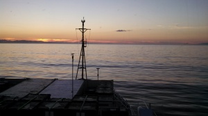
The water was flat calm when we evacuated the mate. After we retrieved the rescue boat and got underway for Ecuador, the winds picked up really quickly. We still had a bunch of stuff to lash and were working fast while we still had the protected waters of Puget Sound. Then as fast as the wind came up, it died and turned out to be a really nice evening as we approached the Olympic Mountains and the Straights of Juan De Fuca:
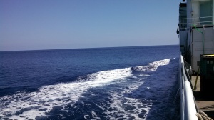
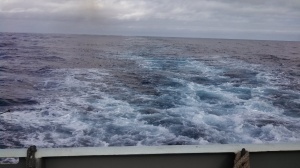
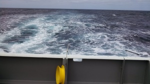
As we approached the West end of the straights we started to feel a pretty good ground swell. As we made the turn at Cape Flattery we got hit on the beam with 14′ swells that lasted for about 12 hours and made the ride pretty sloppy. Further down the coast we turned again and put the swell on our stern and made a nice ride all the way beyond San Diego. Our course lines were obviously drawn by a non fisherman. Everywhere there was good structure like a underwater canyon, ledge, seamount, etc., we were at least 80 miles from it. We passed some very famous fishing spots such as Guadalupe Island, Alijos Rocks, Hurricane Bank, Cocos Island to name a few. Fishing turned out to be a bust for the entire trip and making 12 – 14 knots didn’t help either.
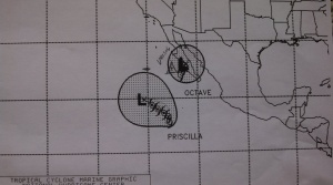
As we made our way down Baja, we started to feel the effects of a tropical depression named Octave followed by a weak system named Priscilla. We ended up get hit with 40 knots of wind and about 15′ seas. The wind petered out very quickly and the swell didn’t last too long either. The next day, Priscilla had strengthened and moved West so we missed her, but she did give us a half of a day of swell on our beam.
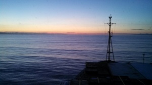
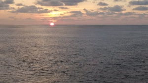
Finally we received some hot, flat and humid tropical heat for a few days.
THIS IS NOT A DRILL! Saturday afternoon, after watch, I was in my rack enjoying some sweet dreams when the alarm rang and the announcement came over the speakers “this is not a drill, report to your muster station, fire onboard”. I slapped on some clothes and hit the muster station. There was a fire in the engine room. It turned out to be a water jacket heater on one of the Cat 3516 main engines. The thermostat shorted out and melted the wires which in turn burned some rubber and made allot of smoke, but no fire. It was put out by turning off the electrical to the unit. It was a good muster and the crew was suited up quickly and efficiently.
Pollywog to Shellback:
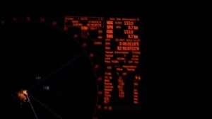
The evening before we arrived in Ecuador, we crossed the Equator. I was a pollywog but now am a Shellback. At the time we crossed, it was pretty tense on the bridge as there were numerous pangas fishing the area that did not show up on radar. They also don’t have lights, or I should say they don’t turn on their lights until you right on top of them! I tried to take a photo of 000 but missed it by a hair:
We arrived in Manta, Ecuador after 16 days at sea. We met the pilot boat and made our way to the pier. At the dock were numerous seiners unloading net loads of super small tunas. These are the super seiners that wrap entire schools in their 2 mile seine nets and have helicopters onboard to find the tuna. It was pretty bad in my opinion.
We tied up, put out the gangway, let the pilot off and greeted the customs and immigration officials. It took several hours to clear into the country. They allowed the oncoming crew and science party to board, but not for us to depart the ship. This gave us time to finish packing, clean our rooms for the next crew, have lunch and just hang out for a bit. It also marked the 80th day I had been aboard and I was ready to get off asap!
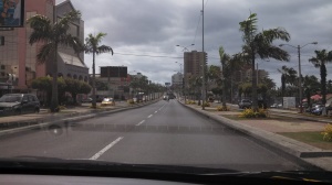
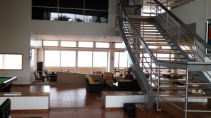
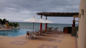
We were finally cleared by the Ecuadorian Customs and several of my crew mates and I went a few miles down the beach to a hotel, where one of them booked a room (their flight wasn’t until the next day). Myself and several others were flying out later that night so we stuffed our bags in the hotel room and made our way to the bar to have some beers and food. I was struck by how nice the roads were in town. I had imagines Ecuador being really bad and broke down, but the little bit of it I saw was pretty nice. The hotel was excellent as was the airport. We only got to see a few miles on either side of the port so we really didn’t get to see too much.
![2544_10151786015544620_116760059_n[1]](https://blueoceanmariner.files.wordpress.com/2013/10/2544_10151786015544620_116760059_n1.jpg?w=225&h=300)
![553905_10151786015389620_872518465_n[1]](https://blueoceanmariner.files.wordpress.com/2013/10/553905_10151786015389620_872518465_n1.jpg?w=300&h=225)
![1385323_10151785509839620_2112334557_n[1]](https://blueoceanmariner.files.wordpress.com/2013/10/1385323_10151785509839620_2112334557_n1.jpg?w=225&h=300)
![1383551_10151786015329620_14348265_n[1]](https://blueoceanmariner.files.wordpress.com/2013/10/1383551_10151786015329620_14348265_n1.jpg?w=300&h=225)
![1381427_10151786015454620_475878214_n[1]](https://blueoceanmariner.files.wordpress.com/2013/10/1381427_10151786015454620_475878214_n1.jpg?w=300&h=225)
![1375286_10151786015279620_1008210202_n[1]](https://blueoceanmariner.files.wordpress.com/2013/10/1375286_10151786015279620_1008210202_n1.jpg?w=225&h=300)
We made our way to the airport and flew to Quito, the capital of Ecuador. It was already dark when we flew in so we couldn’t see too much, but it looks like a real cool place. From Quito we flew to Atlanta, then on to Seattle.
I arrived home and was met by my wife and kids at the airport. On the drive home we stopped in Seattle at the Coast Guard Rec Center and turned in the discharge papers, course certificate and assessments for RFPNW. I’m very happy to finally have that checked off the list.
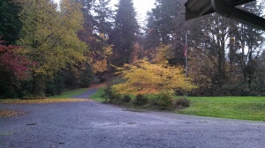
There is a huge difference in the weather between Ecuador and my home, just North of Seattle. Fall has arrived along with the fall colors!


![2544_10151786015544620_116760059_n[1]](https://blueoceanmariner.files.wordpress.com/2013/10/2544_10151786015544620_116760059_n1.jpg)
![553905_10151786015389620_872518465_n[1]](https://blueoceanmariner.files.wordpress.com/2013/10/553905_10151786015389620_872518465_n1.jpg)
![1385323_10151785509839620_2112334557_n[1]](https://blueoceanmariner.files.wordpress.com/2013/10/1385323_10151785509839620_2112334557_n1.jpg)
![1383551_10151786015329620_14348265_n[1]](https://blueoceanmariner.files.wordpress.com/2013/10/1383551_10151786015329620_14348265_n1.jpg)
![1381427_10151786015454620_475878214_n[1]](https://blueoceanmariner.files.wordpress.com/2013/10/1381427_10151786015454620_475878214_n1.jpg)
![1375286_10151786015279620_1008210202_n[1]](https://blueoceanmariner.files.wordpress.com/2013/10/1375286_10151786015279620_1008210202_n1.jpg)