
The vessel “Red October”:

We shoved off at 0500 on Thursday morning to take advantage of the 11′ outgoing tide through Admiralty Inlet that connects Puget Sound with the Straights of Juan De Fuca. We had incredible weather and were able to snap some good photos along the way.
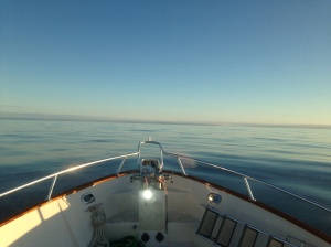
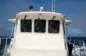
Getting underway with excellent conditions:

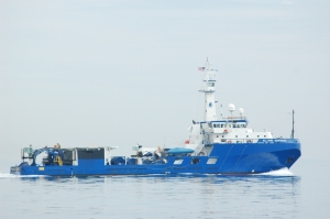
MSRC’s oil spill response ship “W.C. Park Responder” was spotted just off of Port Angeles, WA. with the mountains of Vancouver Island in the background:

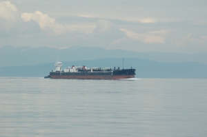
An inbound Crowley ATB:
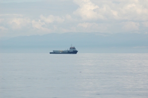
The HOS Arrowhead (I didn’t know HOS operated in the area):
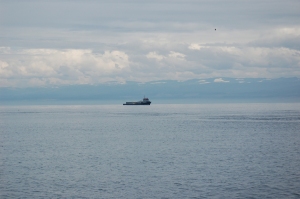
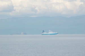
A factory trawler inbound from Dutch Harbor and an outbound container ship:
It took us most of a day to steam out of Puget Sound, through the straights and past Cape Flattery. The weather was perfect in the afternoon:
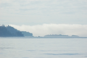
Just as we approached Tatoosh Island and Cape Flattery the fog rolled in. A few moments after this photo was snapped the island disappeared:
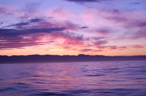
Luckily the fog only lasted for a couple of hours and we had filtered moonlight for our first night headed down the coast. We set a waypoint for Southern Oregon, being very careful to avoid coming inside 350′ of water. This is commercial crab season off the West Coast and the inshore areas are carpet bombed with crab pots. Along the Washington Coast, 350′ of water can be 20-25 miles off. Along Oregon and N. Cal it is more like 10 miles off.
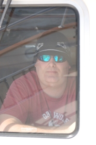
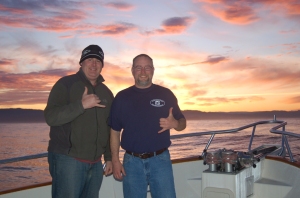
Yours truly:
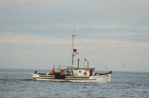
A coastal crabber, usually they fish many species throughout the year:
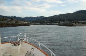
Our offshore route allowed us to set our way point about 330NM South of Cape Flattery. We didn’t have to touch the wheel for something like 32 hours when we altered our course to make a fuel stop in Brookings, OR. Our timing was perfect and we had an incredible sunrise and tied up at the fuel dock just as they opened:
Entering Brookings, OR (Chetco River)
We were trying to tie off to the fuel dock and the USCG was hailing us repeatedly. Thinking something was wrong I answered. They started in with 20 questions like: Where did we come from, where are we headed, how many POB, etc. I was like “At least let us tie up the boat before the quiz”. The funny thing is the base is just on the other side of the channel. I could have probably talked to USCG on the other side in a normal voice. They were watching us from the tower as we were trying to tie up. They must not be very busy at that base.
We got tied off and continued our Q&A session with the coasties. They finally cleared us to carry on and we took on fuel. Here is the Red October at the fuel dock:
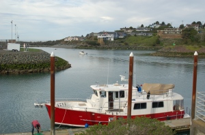
As you can see, the USCG station is right behind the boat across the channel. Talking to the fuel dock attendant, the Japan Tsunami produced waves that came over the wall in the background by 1′ or more. This photo was taken at low tide, so it may look more dramatic. The surge caused 3 or 4 marina docks with boats still attached to break off and float out of the river and be wrecked on the South Jetty. There was around 8 hours of advanced notice of the Tsunami. The USCG and several fishing boats left for deep water and were able to wait for the surge to end.
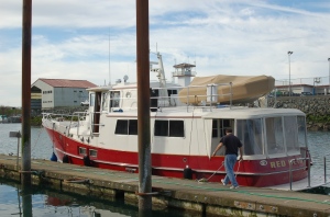
As we were fueling up, three coasties arrived by pickup truck to board us and give us a safety shake down. They asked to see our identification and I handed them my freshly minted MMC that was barely a week old. They radioed in all of our information and made sure we weren’t wanted and then called me over. They were looking at my MMC and flipping through the pages trying to figure out which was my official number. The old paper licenses had it clearly printed as “mariner number”, the new passport style MMC’s say “reference number”. I thought it was classic that the USCG boarding crew didn’t know. All of our gear was in good shape and we passed and were cleared to carry on (again).
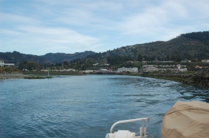
We finished up and headed back to sea. Leaving Brookings, OR (Chetco River):
A few miles from Brookings is the border of California. As soon as we entered California the phone reception turned very poor all of the way to SF Bay. The weather also shifted from being pleasant, following seas to choppy head seas out of the South. My rule of thumb is to avoid South winds (at least in WA and OR). we pressed on and the ride was still good, but we were taking spray and getting tossed around a bit. The Red October has stabilizers and handled the seas just fine.
Overnight along the Nor Cal Coast we had the most impressive Bio Luminescence I’ve ever witnessed. I’ve seen the smaller stuff that looks like magic dust when you wave your hand through the water (look like lots of small glitter). This stuff was the size of golf balls up to the size of a softball. As the boat turned over the boat wake, the wake glowed and sparkled out behind us for about 100′ or so. I tried to take a picture and video but it was too dark and it didn’t turn out.
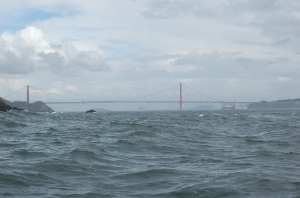
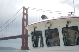
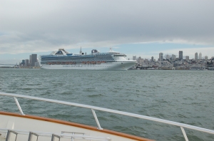
Sunday we arrived at SF Bay and the Golden Gate. There was lots of activity in the bay from cruise ships docking and undocking, sail boats, harbor tours, whale watching tours, bridge watching tours, tours looking at other tours. I counted at least 20 tour boats in operation and another batch tied up along the water front. The coasties ran up on us with a RIB, machine gun mounted and manned and told us there was a safety zone around the cruise ship. Funny thing is, we were not headed towards or near the cruise ship and they had to come quite away across the bay to tell us that. I will admit, that if I were in the USCG and had government fuel to burn and got to have a machine gun on my bow, I’d go balls to the wall everywhere also and I’d have fun doing it.
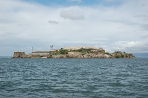
The Rock:
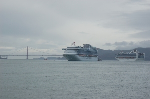
Cruise ship waiting to dock:
Two cruise ships and the Golden Gate Bridge (looking toward sea)
We had to take the boat a couple of hours South of the city. We made it in with no problems, tied up, washed off the boat, got a ride to the airport to rent a vehicle and started the drive home. Before you ask: We drove home because of the volume of stuff we had with us. Life raft, survival suits, and all of the other assorted stuff. It was easier than trying to have the raft shipped home. The total boat trip was 865 miles and took right at 3.5 days with one stop for fuel and USCG inspection.

HOS has a couple boats on government contract up that way.
Looks like it is contracted to MSC. Good to know. Thanks
My dad commissioned Cherubini to build the Red October a few years prior to his death. He made many trips back to New Jersey during the process. I live in the San Francisco Bay Area and I would love to see it docked. Can you let me know which marina it is moored at in the South Bay? It would mean a lot to me to be able to just walk by and see her. Thanks.
Roy,
Thanks for contacting me. I will send you an email with the info you seek. Good luck, Todd
Hello…. I just happened upon this article. If you’d like, please contact me. I’m the owner of Red October and you are more than welcome to stop by. On the San Francisco Peninsula.
Roy,
You are more than welcome to call me. I’ll be more than happy to show you through Red October. I’ll have Red October for many years to come.
Pam
650-207-2253
ps4010@aol.com
Roy,
The current owner of Red October would like to speak with you. Would you be ok with that? If so please provide a phone# or email and I will pass it on.
Thanks,
Todd